A short distance east from Skelton Tower overlooking Newtondale are Levisham Quarries, a range of sandstone workings along the northern edge of Levisham Moor plateau. Not more than 20 feet deep they seem to have worked the sandstone along the outcrop; waste rock and overburden being piled at the top of the valley slope opposite the working face instead of being formed into finger mounds into the valley. At the western end lying on the quarry floor is a large timber, over 12 inches square in section and about 8 feet long. It may have stood on a flat stone near its present position, as part of s derrick or tripod for loading wagons.
A well-defined incline runs down the valley slope from the quarries; it has an uneven gradient and is not straight but a length of flat-bottomed narrow gauge rail was found close to it. The rail is quite light and about 15 feet long.
Close to the railway boundary fence the route levels and becomes very broad, although overlaid by a landslide. Through a gate into the railway property the route continues to a loading dock several feet high above the standard gauge railway (now the North Yorkshire Moors Railway).
A couple of hundred yards south from here is the former junction with the Levisham mine branch at the remains of Pit Farm. On the west side of the railway opposite are the remains of a house, either related to Pit Farm, or provided by the railway for platelayers.
Along the branch away from the junction the formation becomes better defined and runs along an embankment. A range of fallen buildings lies on the east side of the branch, then further on a raised stone wall, intended to be a loading dock. Above this is the mine site at SE 823928.
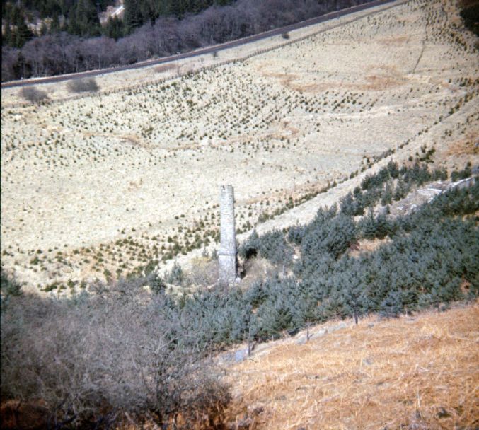
A modern track leads up to the single shaft, the access route for a bulldozer used about 1970 to fell the chimney and fill the shaft. East of this track is a small rectangular reservoir, then near the shaft a small engine bed much damaged.
West of the track a depression marks the site of a boiler plant, now filled with stone from the demolished chimney. The base of the chimney was square and had arched flues on the south and west sides. The northern side has been removed to cause the chimney to collapse in that direction. South of the chimney are a couple of flat stones forming part of an engine bed. These have been located within a stone building up against the chimney; as the engine bed east of the track is opposite this may have been included within the same large building north of the shaft.
Further south, and into the hillside, is the circular shaft, 9 feet diameter, stone lined and completely filled although originally about 240 feet deep. Between the large stone building and the shaft has been a connecting building or passage to an inset in the shaft. Within this structure is a squared area marked by nine holding down bolts suggesting a large square bearing was positioned here.
Presumably a steam engine north of the shaft drove pumps in the shaft via a geared drive, surface quadrant, and spear rods.
On the hillside several feet above the level described is a larger leveled area made out of the hill. On the south side is a lengthy stone wall, heavily buttressed in places, but the north side of the leveled area is formed from piled up material. This area is vaguely dumb-bell shaped with the shaft in between, and suggests either a horse-gin or a capstan located either side.
On the hillside several yards above the mine site is a small mound and short drift remaining from a trial working of the Cornbrash, another failed attempt to make money out of the minerals within Newtondale.
Simon Chapman

This is an interesting piece, especially the old photograph. I had a look at this site during summer 2012. It appeared someone has been doing a fair amount of ‘work’ on the site of the pit for example brush clearance, stonework clearing and general scraping off to expose the site. Wondered if you knew anything about the Pit Farm site. Would it originally have been a property associated with Walker’s Pit do you think – or maybe something to do with the original horse drawn railway (perhaps stabling spare horses). I’d be interested to hear your comments on this.