WEARDALE JUBILEE WANDER 5th June 2012.

While most of the country was distracted with celebrating the Diamond Jubilee a small group from CHMS was investigating other minerals in the North Pennines. Simon, Gavin and John first congregated at Rookhope Arch where Neil soon joined us and we were introduced to John Crompton, former surveyor of various mines in the local area. John brought along a County Series 6 inch map of 1930 covering Rookhope district, and also a plan of the older workings of Grove Rake. After much debate and a few good stories John left with a few rock samples from Boulby. Eric and Dave then arrived and we returned to the village hall car park for a wander around Boltsburn Mine.

About a 100m to the west of the shaft is a level, West Level surprisingly, which is ankle deep wet and soon comes into an area of room-and-stall ironstone workings. The ironstone seems to have been quite soft and in a deposited state, not the stratified condition we are used to, and was worked by pick although a couple of drill marks were found. The main adit is stone lined and at a weak point they appear to have reinforced the roof with old wrought-iron rails held in place with more modern flat-bottomed ones. The main adit continues a short distance beyond the ironstone workings, again stone lined until a fall blocks further progress. The fall is dry but the level is wet and Neil noticed just in front of the fall wooden flooring with a substantial flow of water coming out of it, so if anyone visits watch out for this hazard. We inserted John’s walking stick into the hole, all 4 feet 7 inches of it, so depth is unknown.

Whilst everyone passed over a rail in the level, it was Simon who looked at it closely and it proved to be a length of plateway, the third different type of rail to be seen in this short level. Altogether a most interesting short excursion.

Back at Boltsburn Shaft we managed to pull ourselves away from gazing at the collection of pre-owned machinery, saucepans, stoves and about everything else, to look at the shaft top in close detail. The shaft is circular and stone lined and flooded almost to the top. Running north-south across the western side has been the pumping gear operated by a water-wheel. Within the shaft itself the top of an open vertical pipe is apparent with a steel rod rising out of it up to a coupling at the end of a steel quadrant perched on the north side of the shaft. This quadrant has a base length of about 12 feet with a central strut forming the triangle at about 6 feet. The north end of the quadrant has a square balance box in place. Dangling down from the top of the triangle is the drive rod, a wooden arm about 6 inches square, apparently driven from a waterwheel further north, and sawn through.

South of the vertical pipe is another one in the shaft with its rod projecting upwards but nothing else. In the south side of the shaft is another position for a quadrant similar to the one remaining but the quadrant itself is missing and the space is full of rubbish. Both positions appear to be modifications to the shaft top made of concrete and the use of a quadrant made up of riveted steel suggest a possible installation date of c.1900.

The survival of such a quadrant on a mining site in Britain may now be unique so a return visit for surveying is planned.

Unfortunately rain and the time drove us away for shelter and lunch and then we headed upvalley to Grove Rake. Immediately noticeable was the side wall of the secondary winding house which has collapsed but makes the machinery inside easier to photograph. After a mooch around we wandered up to the site of the drift at Fraser’s Grove for a bit of fossicking on the dumps of spoil. We also found a drill rod of good length.

Back at the main mine we looked closely at the remaining headgear which is equipped with a single man-riding cage and a counter-balance. There are four guide ropes for the cage, two for the balance, and another two between as rubbing strips. There is an inset at ground level where the cage now sits, blocking access into the shaft. Above is another inset then above that a boxed-in section with steel grooves inside where a skip could be angled away from the shaft and unloaded into a chute. At this level there is also a ‘cabin’ on the steps up the headgear perhaps for an operator of the chute mechanism. Within this enclosed part of the headgear the expanded mesh steel flooring is failing through rusting.

Above here is another inset, presumably for unloading the cage in the event of an overwind. At the top are the two pulley wheels, with one missing piece of flooring.

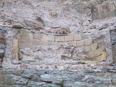
Next stop was Allenheads for a look into the re-opened Horse-level, and what a beauty that is! A cobbled floor, stone walls and arched roof, initially straight in then soon bends and descends to the left to end in a complete collapse. All the stonework was most impressive and the odd curtains of hanging roots added to the Gothic atmosphere! A word of warning – the steel gate is not yet fixed in place although it looks it so check first before it falls on any visitors.

We went up past the blacksmith’s shop and small exhibition centre (mineral specimen display cupboard collapses if touched) to look at a modern steel magazine then a much older stone one of unusual design, another structure worthy of surveying. We were following the vein(s) westward onto the open moor amongst shafts with gin circles and mounds and all manner of disturbed ground. All the shafts appear to have been capped, perhaps by British Steel some years ago. We also took great delight in looking at the remains of an old stone cottage in this very exposed location.

With the clock approaching 7 pm we departed Allenheads to reconvene at our regular port of call in Frosterley, the chippy. And so the weary travelers headed home to bed, to be tucked up dreaming of all the exciting places they had visited and things they had seen and envious of Simon and Dave who had reached the dizzy heights.

Nenthead and Rampgill 13/05/2012

6 members of CMHS turned out to show their support for the formation of the new society that aims to conserve the Nenthead Mines site.

Although it took the combined power of all 5 members to restrain John when it was suggested that ‘non-internet’ users may have to pay more to receive hard-copy communications.

After we managed to prise Gavin away from the free scones, the group had a quick but interesting blast around Rampgill taking in the Horse Whim before pushing through the NORPEX digs, past Rampgill Shaft and beyond the Boundary Gate into Northumberland.

More photo from Gav.

Ayton Monument (40 years ago)

On Saturday we had the good fortune to meet an NMRS member who had been to Ayton Monument 40 years ago with John Owen, what follows are some observations he sent me.

Things change over 40 years. The incline was a grassy track, no fishing lake, no trees, powder store apparently in fair condition and clearly seen, the little bit of the abandoned drainage drift was not a stagnant pool but quite dry, although I seem to remember a small (probably modern) pipe less than 6″ emerging from the hillside. We were there in a very dry period. Inbye the arched drift from the fan house was clean and dry and the small furnace remains were much as it is now. There were large roots growing through from the surface at the blocked entrance to one of the drifts, which in poor light resembled electric cables! The main change at the large furnace was the total disappearance of the seat at the furnaceman’s refuge. When I was there with members of YGS and John Owen it was in fair condition and even had rags and tatters of some kind of screen, probably to protect the sitter from draught, which must have been gale force.Then, we didn’t get very far inbye, John’s safety lamp didn’t shout at us like your modern electronic device, but it gave warning of poor air early and with what was perceived as a degree of finality so we took notice. I’m glad of new technology because I saw a great deal more and had the privilege of some very good conversation. The crowning glory was to see John Owen’s photo. I’ve now bought Richard Pepper’s book.

Clitherbeck Coal 30/4/2012

After a brief visit three years ago, I returned with Chalky from the NYMCC to take a look at the site again as he’s particularly interested in the water flowing out of the workings.


The first point of note “1” was a capped shaft that I had missed on a previous visit, I need to return for a depth measurements and to lower a camera through the gap as it looks interesting.

Point “2” is the fenced and capped shaft I had previously visited in 2009 but with a new photo down added.

Point “3” is the final capped shaft, again with a new photo through the crack.

Flowing water can be heard in shafts 1 and 2 with shaft 3 sounding sumped.
Point “4” on a similar alignment appears to be a flooded pit, perhaps the one labelled as ‘Proud Sinks Pit Into Water Level” on the old map.

Next we made an effort to look for the two old water levels in the beck suggested by previous research and maps, there was no sign of either of these, although a trickle of water was emerging around point “5” with a scatter of stones on the ground.

Next port of call was the outfall at point “6” which made Chalky very happy indeed when he took some water samples and measurements, bits of coals were even visible in the water bubbling up.

The next appearence of water is at point “7” which is approximately that marked as ‘Lord Downes Pit” on the old map and a manhole and cattle trough at point “8” which seemed more like a spring rather than mine water.

Another interesting area was that around point “9” where a further shaft that was pretty much the twin of the one at point “6” was found, although this one was blocked and dry, nearby at riverside there was some ocherous water leeching out, although I suspect this blockage is forcing the majority of the water out of point “6” if the water level follows the suggested line to this point.

All in all, theres a lot going on Clitherbeck that probably warrants a lot more research.


Bottle Bodger

I’m not trying to compete with the mighty Gav here, but here are a couple of local broken bottles i’ve cleaned up from our recent trips (nothing removed from underground)


We have “C. Garnett Middlesbro” which came from the rubbish in the bottom of the shaft project


This “Richardson Bros Normanby” has lying by the track as I was leaving on Saturday afternoon.

C.M.H.S. Shaft-Cam Version 1

I have constructed a device to be lowered into shafts to video the conditions and get gas readings, all it needs now is an amusing alliterative name !

My first thought was “Twiggs Terror” (as in what i’ll be feeling at the prospect of losing £500 of gear down a mine shaft if something goes wrong)

I may reconsider positioning the gas meter at the top as its not water-proof and everything else is, incase we have a splash down.


Meet 10/3/2012 – Levisham Ironstone Mine

A short distance east from Skelton Tower overlooking Newtondale are Levisham Quarries, a range of sandstone workings along the northern edge of Levisham Moor plateau. Not more than 20 feet deep they seem to have worked the sandstone along the outcrop; waste rock and overburden being piled at the top of the valley slope opposite the working face instead of being formed into finger mounds into the valley. At the western end lying on the quarry floor is a large timber, over 12 inches square in section and about 8 feet long. It may have stood on a flat stone near its present position, as part of s derrick or tripod for loading wagons.
A well-defined incline runs down the valley slope from the quarries; it has an uneven gradient and is not straight but a length of flat-bottomed narrow gauge rail was found close to it. The rail is quite light and about 15 feet long.
Close to the railway boundary fence the route levels and becomes very broad, although overlaid by a landslide. Through a gate into the railway property the route continues to a loading dock several feet high above the standard gauge railway (now the North Yorkshire Moors Railway).
A couple of hundred yards south from here is the former junction with the Levisham mine branch at the remains of Pit Farm. On the west side of the railway opposite are the remains of a house, either related to Pit Farm, or provided by the railway for platelayers.
Along the branch away from the junction the formation becomes better defined and runs along an embankment. A range of fallen buildings lies on the east side of the branch, then further on a raised stone wall, intended to be a loading dock. Above this is the mine site at SE 823928.
A modern track leads up to the single shaft, the access route for a bulldozer used about 1970 to fell the chimney and fill the shaft. East of this track is a small rectangular reservoir, then near the shaft a small engine bed much damaged.
West of the track a depression marks the site of a boiler plant, now filled with stone from the demolished chimney. The base of the chimney was square and had arched flues on the south and west sides. The northern side has been removed to cause the chimney to collapse in that direction. South of the chimney are a couple of flat stones forming part of an engine bed. These have been located within a stone building up against the chimney; as the engine bed east of the track is opposite this may have been included within the same large building north of the shaft.
Further south, and into the hillside, is the circular shaft, 9 feet diameter, stone lined and completely filled although originally about 240 feet deep. Between the large stone building and the shaft has been a connecting building or passage to an inset in the shaft. Within this structure is a squared area marked by nine holding down bolts suggesting a large square bearing was positioned here.

Presumably a steam engine north of the shaft drove pumps in the shaft via a geared drive, surface quadrant, and spear rods.
On the hillside several feet above the level described is a larger leveled area made out of the hill. On the south side is a lengthy stone wall, heavily buttressed in places, but the north side of the leveled area is formed from piled up material. This area is vaguely dumb-bell shaped with the shaft in between, and suggests either a horse-gin or a capstan located either side.
On the hillside several yards above the mine site is a small mound and short drift remaining from a trial working of the Cornbrash, another failed attempt to make money out of the minerals within Newtondale.

Simon Chapman


Site in 1968 before chimney was demolished